Groundwater
One of the main targets of the CatchmentCARE project was to install 50 groundwater monitoring boreholes across the 3 Catchments to help better understand groundwater in the cross-border catchments and the interaction between groundwater & surface water bodies.
A groundwater monitoring borehole is a hole that is drilled in to the ground, normally 5 to 12 inches in diameter. They can be drilled to a depth of only a few metres to over 100 m below the ground surface. They have a number of purposes:
- To collect samples of groundwater to tested water quality
- Determine how much water there is underground and flowing through it
- Measure levels of the water table using sensors, which can help with water resource planning and understanding the effects of climate change.
- They can be used to trial new technologies or to better understand groundwater processes, helping us to protect the environment
There are large quantities of groundwater resources that we use for water supply and keep our rivers, lakes and wetlands alive. It is vital that we understand and look after them. Groundwater monitoring boreholes allow us know how they operate and what their status is.
They are constructed using a drilling rig, supervised by a qualified hydrogeologist who collects samples of the ground as it brought up to the surface. The top of a borehole is finished preferably above ground and will often look like a vertical pipe sticking out of the ground, but they can also be finished below ground in a protected chamber.
Once completed, they can be surveyed using the likes of downhole cameras or by carrying out pumping tests. The hydrogeologist will use this information to calculate useful values that can then be used to model groundwater systems and make future predictions. These tests help in determining whether water quality is improving or deteriorating.
 The Geological Survey of Ireland (GSI) and the British Geological Survey (BGS) successfully installed 51 Groundwater Monitoring Stations over the course of the project.
A link to the Legacy Reports where you can find out more about this area of the project can be found here – Click here
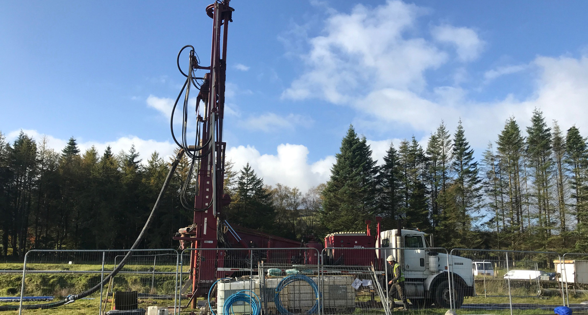
Drilling Rig
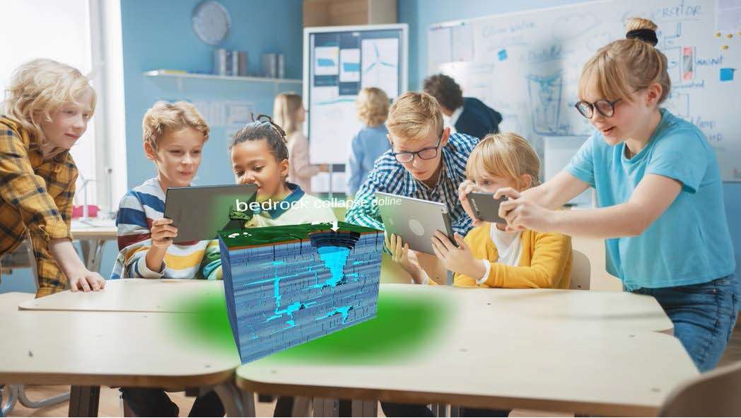
Groundwater Virtual Reality Experience
As part of Groundwater Monitoring Package, the Groundwater Team examined how best to communicate the findings from their work and developed a groundwater visualisation tool which includes state of the art Augmented Reality (AR) and Virtual Reality (VR) technology.
This technology is designed to be inclusive and also easily portable. The application has a solo mode or a class mode which is ‘teacher’ led and can be tailored to any specific aspect of the Groundwater story through a user interface accessing modular learning, covering an in-depth approach to Groundwater.
The CatchmentCARE project VR application is being used as an educational asset in local schools and for community outreach purposes.